
Revere ZIP Code Coverage
Postal geography has a different job from municipal geography. The primary Revere delivery ZIP is 02151. A December 2024 USPS Office of Inspector General report says the Revere Carrier Annex serves both 02151 and 02176. USPS postal labeling also routes 02176 to Revere, Massachusetts 02151. That is strong service evidence, but it does not settle the delivery class or precise street boundary for every address. Use a full-address USPS search when the distinction affects a record search or mail delivery.
| ZIP | Areas covered | Post office evidence | Search note |
|---|---|---|---|
| 02151 | Revere delivery area | Revere Carrier Annex service | Primary Revere ZIP confirmed by USPS and city addresses. |
| 02176 | Revere-related delivery geography | Revere Carrier Annex service | USPS labeling routes it to Revere MA 02151; confirm its exact address-level use. |
| 02150 | Chelsea, beside Revere | Chelsea ZIP context | Adjacent to Revere, not a Revere city ZIP. |
| 02152 | Winthrop, beside Revere | Winthrop ZIP context | Adjacent coastal context, not a Revere city ZIP. |
02150 and 02152 belong in a boundary check, not in a list of Revere city ZIPs. Chelsea and Winthrop sit next to Revere, so a mailing label, neighborhood reference, or location description can create a false match. The postal label should be checked separately from the city boundary and the parcel location.
Note: Carrier-annex service confirms postal operations, while USPS address lookup resolves the delivery result for one complete address.
Revere ZIP Code Delivery Footprint
The two-ZIP service footprint is a useful geographic clue, especially in a dense coastal city near Chelsea, Winthrop, Saugus, Everett, and Boston or East Boston. It is not a citywide resident roll. The OIG report describes 02151 and 02176 together as the Carrier Annex service area, while the USPS tool handles the question the report cannot answer: which ZIP the Postal Service assigns to a particular street address.
Use the USPS ZIP Code Lookup to begin an address-level check.
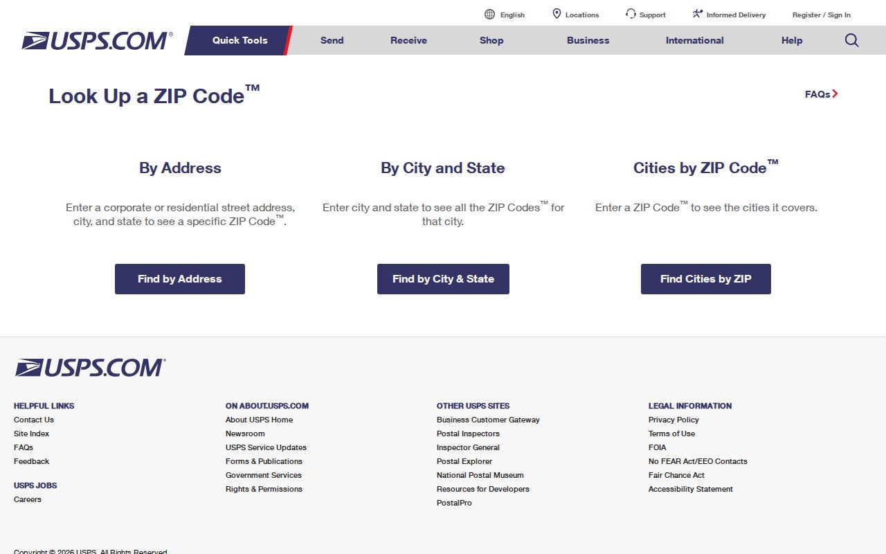
USPS accepts either a complete street address with city and state or a city-and-state search. The first route verifies one address; the second returns the ZIP choices USPS associates with that place name.
For broader Revere geography, the USPS OIG Carrier Annex report is the official source for the two-ZIP service finding. Do not infer that every address within a general service area has the same delivery classification.
Revere ZIP Code Lookup Fields
The public USPS tool has two documented paths. City and state are enough to list ZIPs for a place. A complete street address, city, and state is the route for checking one postal address. The live form is dynamic, so its on-screen controls can change, but the documented inputs and purpose remain the same.
| USPS search field or path | Type | When required | What it answers |
|---|---|---|---|
| City and state | Place search | Use when listing ZIPs for a city | ZIP choices USPS lists for that city and state. |
| Complete street address | Address search | Use with city and state for one location | The ZIP assigned to that exact postal address. |
| City and state with address | Address context | Required alongside the complete address | Separates similar street names and confirms the postal presentation. |
A city-level return is not proof that a specific parcel uses every ZIP shown. Likewise, an assessor card may use a legal or situs address rather than the postal format. Keep the original search text and compare the results before treating two near-matches as the same place.
Revere ZIP Code Map Context
After USPS confirms the postal address, Revere GIS supplies the local map context that a ZIP result cannot. Its neighborhood layer includes Beachmont and Library, and Quick Maps can add voting, flood, transit, trash, recycling, and street-cleaning context. Those map layers help place a parcel within city services. They do not create a verified ZIP-wide roll of people.
Use the USPS address lookup again when a map label and postal result seem inconsistent.
The ZIP returned by USPS should stay attached to the exact address entered. Then use the GIS parcel result, its assessment panels, and the city layer needed for the question at hand. That sequence prevents a neighborhood or service area from being mistaken for a postal boundary.
Revere ZIP Code Search Steps
A ZIP code can focus a Revere search area, but the available public sources are keyed in different ways. USPS is the verification tool. Revere GIS is keyed to an address, owner name, or parcel ID. Local voter records are requested through the Election Department, and the research did not confirm a public statewide ZIP search. Start with the record type that matches the question rather than expecting one ZIP-wide list.
- Enter the city and state in USPS to identify the applicable ZIP choices, then use the full address to confirm one postal address.
- Search the Revere GIS by verified address, owner name, or parcel ID and select the result row for parcel information.
- Review the Owner, Assessment, Sales, and Links panels. Record the parcel ID and legal or situs address before moving to another source.
- Use Quick Maps and map extent for a ZIP-area study. GIS documentation does not confirm a public ZIP-wide resident filter, so do not represent a map result as a household count.
- For registered-voter information, contact the Revere Election Department about a local public-record request and respect the confidential-voter restrictions.
Once a ZIP and address are verified, the Revere street directory is the better route for the full address-by-address records trail. A postal zone alone cannot replace a parcel, deed, or local election record.
Note: The city confirms an online assessor database, but its public materials do not document a ZIP filter for the live Patriot interface.
Revere ZIP Code Address Forms
Three address forms can describe the same property without being interchangeable. The situs or legal assessing address is the municipal identifier used on the parcel record and often on permit work. A mailing address is where correspondence goes and may be outside Revere. A postal address is the USPS presentation with a ZIP. A mismatch is a lead to check, not proof that a person lives at the property.
Revere GIS documentation gives 281 Broadway, Smith, and 15-255A-1 as examples of address, owner, and parcel-ID searches. The parcel ID is especially useful when a suffix, street format, or postal label does not return a match. For older land records, the legal description, plan, or book and page may succeed where a street address does not appear at all.
The City’s CitizenServe instructions add a practical warning: a postal address can differ from the legal assessing address. When an address-based permit search fails, try the legal address or parcel ID rather than assuming no activity exists.
Revere ZIP Code and Older Addresses
Modern ZIP code results cannot resolve every older Revere address. Massachusetts records identify the city as North Chelsea after its 1846 incorporation, Revere after 1871, and a city after 1914. Nineteenth-century directories, maps, newspapers, and deeds can therefore use North Chelsea, Chelsea-area, or Revere place names for related local history. Test more than one place name before deciding that an older address is absent.
The research did not locate an official Revere street-renumbering or renaming year. Compare directory street indexes with Registry legal descriptions, plans, city maps, and newspaper notices instead of forcing an old address into a modern postal format. A current ZIP is useful for today’s delivery question, while those older sources establish the historical address trail.
Revere ZIP Code Boundary Checks
ZIP boundaries are mail-routing areas, not municipal borders. Revere’s edge context makes this plain: 02150 is Chelsea and 02152 is Winthrop, even though each can arise in a nearby-address search. Neighborhood names are also not boundary proof. Revere GIS can place an address in a neighborhood, voting, flood, transit, or service layer, but those layers answer different geographic questions.
For a city record, use the legal or situs address and parcel ID. For mail, use the USPS result. For a deed with an older or incomplete street reference, use the Registry legal description or plan. The research did not find an official Revere street-renumbering year, so historical addresses should be bridged through directory street indexes, maps, plans, and newspaper notices rather than assumed to be unchanged.
- ZIP and ZIP+4
- A ZIP identifies a broad postal delivery area. ZIP+4 adds a smaller delivery segment for a more precise mail address.
- PO-box or special-delivery ZIP
- A ZIP may be assigned for post-office boxes or a special delivery use. The research did not confirm that delivery class for 02176, so verify it with USPS.
- Unique ZIP
- A ZIP reserved for one large recipient or organization. No Revere unique-ZIP designation was confirmed in the research.
- Carrier route
- A postal delivery sequence within a ZIP. It is not the same thing as a city boundary, parcel, or list of people.
Revere ZIP Code Records Scope
Revere ZIP code work can identify postal and geographic context, not every person connected with a place. GIS returns parcels and parcel-linked owners. The assessor and GIS can show a mailing address that differs from the site address. A local voter list concerns registered voters and has protected entries. Historical directories are organized around older street and address evidence, not modern ZIP coverage.
The Massachusetts statewide voter file is not public, and no official public ZIP search was located for it. USPS, GIS, permits, and voter records should therefore be treated as separate tools with separate limits. Use them for a lawful personal purpose, keep confidential-address protections intact, and avoid drawing conclusions beyond what each official record actually states.